After doing the initial weather check it is now time to prepare the actual flight plan. There are loads of free and payware tools available for this task. You can of course also just continue using SkyVector for this job and do your fuel/vertical navigation planning manually, it really is up to you. Back when I first started flightsimming I just bought used expired enroute-charts from eBay since they never became outdated in FS9 land.
Real Life Inspired Route Planning
The I flight I chose in my last post will take us from Yellowknife (CYZF) to Edmonton (CYEG) in the FlyJSim Boeing 737-200. This was motivated by watching JustPlanes’ Canadian North program recently (find a nice summary here). Since it is based on a real world flight, we might as well check the real route out first, to do that you can fire up any of the public flight tracking sites out there. In my case I used FlightAware.

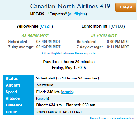
The only thing I am interested in on this page (see Figure 1) is the “Route” row in the table, specifying this particular flight was using the following route:
CYZF DCT 5800N DCT 11400W DCT TETAG TETAG1 CYEG
The way this is read is “Waypoint Airway Waypoint Airway Waypoint…", the first and the last waypoints being the departure and destination airport respectively (not mentioned in FlightAware’s route) and direct legs off any airways shown as DCT (also not mentioned).
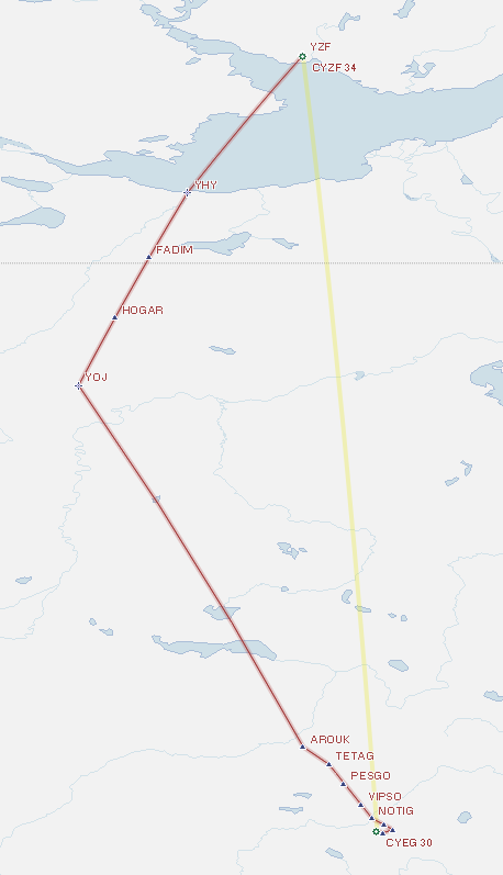
This is pretty much equivalent to directly going from Yellowknife to the TETAG1 STAR for Edmonton (more on STARs in a later post). Quite the boring route but it serves as a great example. You would not be able to do this flight without any RNAV capabilities thus requiring the use of the INS mentioned in the previous blog post. Interestingly, if I let my flight planning software do the route calculation it comes up with a very awkward route setup (see Figure 2).

This is due to it trying to avoid any direct (DCT) legs in the flight plan and trying to find feasible airways on the way. This results in a 9% longer flight plan distance than strictly required. Usually in congested airspaces this is probably still the right way to go (e.g. in Europe) but since there is not a lot of activity to be expected in northern Canada, let us stick with the more direct real world flight plan this time.
In the next blog post I will show how I set up the route in the flight planning software and how it does the fuel planning for me.